
My Experience
Not only is this our first summit walk after an almost 2 months long lockdown due to COVID-19 in 2020. It's also the day of winter solstice in the Southern Hemisphere. This marks the shortest day of the year. The good thing about this: From now on, days are getting longer again. A hooray for this, I say.
But let's do a quick hop back into the past...
We already arrive the day before. Originally, the idea was to do the summit walk up Mt. Lyndon then and do another peak in the area the next day. But, the days are short and also we left the house a wee bit too late. Yep, we're awesome like that.
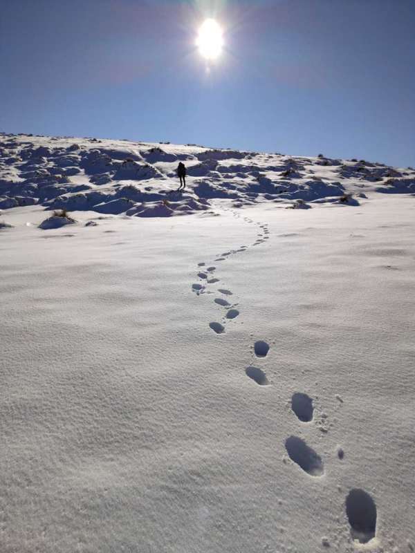
We walk up what, I guess, is half way to the summit, trying to figure out a path through the snow. Apparently we're the first ones doing the walk after fresh snow. Or we're pretty darn off path. Who knows. Our phone map apps show a path where we're walking but it's unmarked. I find this all the more enjoyable because we're able to puzzle our own way up.
We decide to turn around after roughly 1.5 hours of walking uphill. Off to Lake Pearson DOC campground which is a 30 mins drive away towards Arthur's Pass. It's $8 per night and person. Pack some cash if you don't have a DOC season pass or you don't book online in advance (which you can do here). We're quite happy with our choice as we can put up the tent and have dinner while the natural light is still on.
Now, hopping back into the future... (You've got no idea how happy it makes me to use this phrase...)
Present Darryn and Saphi make their way up to the summit again. We're incredibly relaxed and happy having been able to finally sleep in our tent again. Nothing beats sleeping outside. Well...outside as in protected by our tent walls, of course.
Back at the start of the track, we're presented with an almost mysterious atmosphere. For the first wee bit uphill we're walking through thick low clouds. No surrounding peaks and few signs for orientation to see. It's still taking us a fraction of the time to get as far as the day before using our ready made footpath. I'm up front using my expertise as a navigator. Darryn is silently following me without making any remarks. I take this as a good sign.
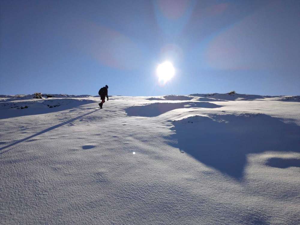
Some of my steps have me sink into the snow up to my knees. I love these kind of walks. As long as I am somewhat dry and the world is not spitting down every possible weather it can offer at us, I'm happy. Now that I'm thinking about it...Even with horrible weather conditions I'd very likely be jumping around like a crazy little reindeer. 1.5 months in isolation in a tiny flat with occasional runs in the park across the road and now in the midst of winter wonderland. Appreciation is the word of this day, I guess.
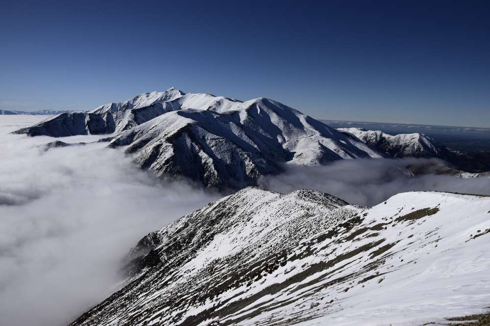
The weather conditions could also not be any better actually. We reach the top of the layer of clouds. The damp cold form the morning is replaced by warming rays of sun.
A few more knee deep snow sinks later we reach the summit. The views are simply increíble. I'm able to see the peaks of the Southern Alps covered in snow for the first time. I get a warm feeling being right there in that moment. Out of practise as we are we forgot our maté things. I know, I know, how could this happen, right?? No maté at the summit for us this time. We still take our time and take in all the beauty unfolding around us.
The way down is much easier. Again, we're just stepping into our premade footpath. Back at the car, we admit to ourselves that our legs are a wee bit tired.
Tired and grateful, just how I like to finish my tramps.
Leave a comment*
(*Please see A word or two.)