My Experience
Arthur’s Pass National Park is one of my favorite locations in the South Island of New Zealand. Coming from Christchurch and taking the SH 73 you will find yourself driving along a picturesque landscape. Once you leave the Canterbury Plains behind, you'll pass the crazy boulders of Castle Hill, just to arrive within the first mountain bits of the Southern Alps.
When attempting Avalanche Peak trail I recommend to arrive the day before and sleep in or close to Arthur’s Pass village. We camped at Klondyke Corner which is a 10 mins drive away from the village and the start of the tracks. It’s a DOC campground which means you pay a small fee for using it. A kitchen area and toilets are provided. If you intend to use DOC campgrounds without paying in advance or having a pass, make sure to bring some cash with you. It works on trust, meaning you put money in a box. This one was $8 per person when we slept there.
We, as in Darryn and I, walked the trail in early March 2020, so beginning of autumn. The weather conditions were in our favors which made this hike quite a relaxing walk for us. Can't go on without giving a bit of a warning though: DOC set up signs at the beginning of both tracks making sure people are aware of the dangers. A lot of people underestimate the difficulty, start too late in the day or with bad fitness and little experience. They then find themselves getting lost in the dark or similar worst case scenarios. Avalanche Peak didn’t get its name for no reason. That said, there is risk of avalanches depending on season and weather.
Pack enough food and water. Put on and pack the right clothes. Be mindful of weather. Watch your steps. Be careful. And you’re good to go.
As mentioned before we walked Avalanche Peak Track up and Scott’s Track down. We parked the car in the car park for the Devil’s Punchbowl waterfall. You can do this as a loop or walk the same track up and down. I would say, both are of the same difficulty. Scott’s Track felt a bit more relaxing for my knees than I’d imagine Avalanche Peak Track to be. But that is just interpretation and no real experience as I've only done the loop once so far. As a reference, DOC also recommends going up Avalanche Peak Track and coming down Scott’s Track.
Given season and weather conditions, I considered this a fairly easy hike for the level of fitness and experience I was in by that time. But I’d say that it definitely requires a certain level of both of those to give you full enjoyment. That said my eyes were on the path for most of the time watching out for roots and rocks. The underground changes from forest ground and tree roots to rock once you cross the bushline. One of the reasons why with rain/snow on the same or previous day(s) the hike becomes far more challenging.
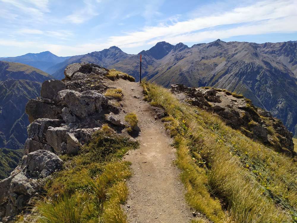
I should mention that I favor steep hikes and this is definitely one. The entire track is well marked. The start of the Avalanche Peak Track is just behind the Arthur’s Pass Visitor center. You will come by a memorial made up by a hiking boot.
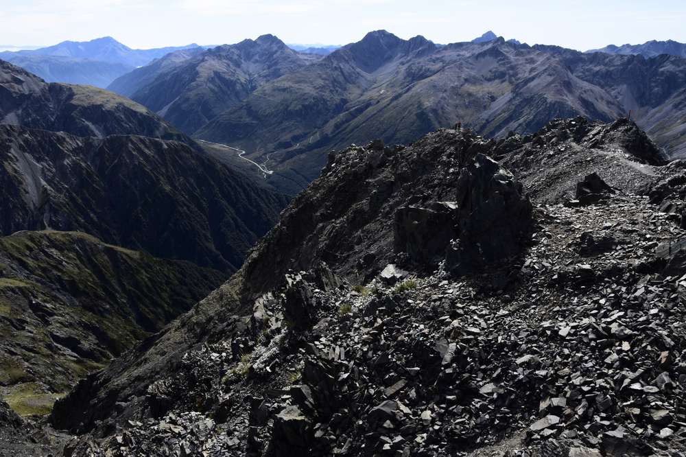
We started Avalanche Peak Track around 9am and left Scott’s Track around 2:30pm. We arrived at the top around 11:30am and enjoyed a nice and long Mate break with astonishing views for about an hour before we headed back down.
We passed a few smaller waterfalls on the way up. On the way down the Scott’s Track we were rewarded with some neat views of the Devil’s Punchbowl waterfall on the other side of the highway. If you have time, have a stop there afterwards. It’s just a small walk from the parking lot.
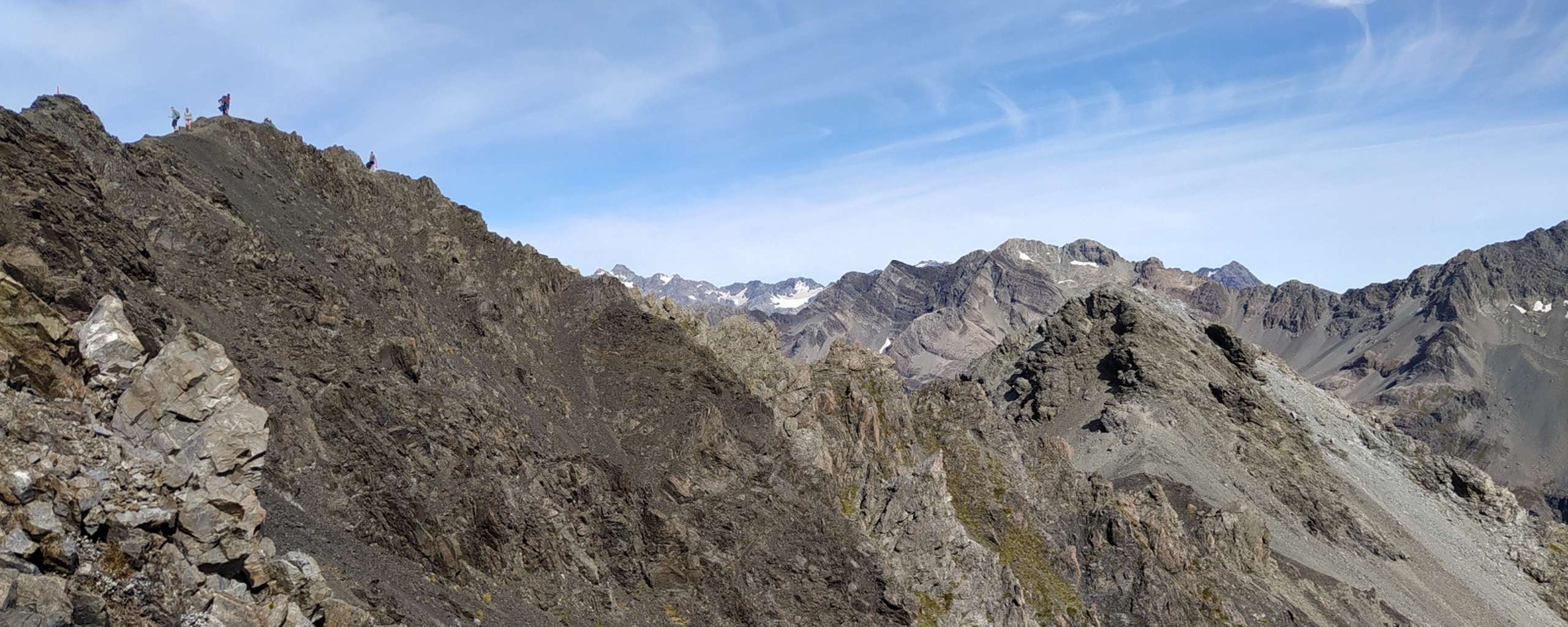
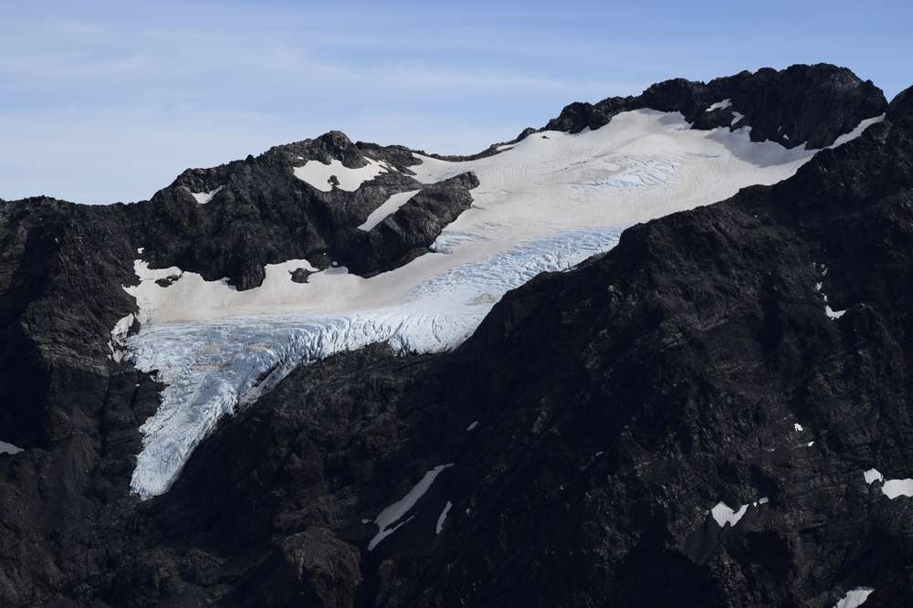
The last few hundred metres to the actual summit of Avalanche Peak are along a mountain ridge. If you have issues with fear of heights or falling this part may be a bit of a challenge. There are enough rocks to hold on to feel safer and the path is wide enough. With hardly any clouds we had the chance to take in some mesmerizing views of the Southern Alps. Summit matecito time at its best.
Scott's Track faces the West of Arthur's Pass NP. So again, nice views guaranteed if weather permits.
Really not ideal was that Darryn started having some issues with his bad ankle on the way down. Guess, the over 2 months long lockdown in 2020 came just on time for some forced recovery. This is future me talking though. Obviously we didn't know by the time we did this hike that a bit more than a week later NZ would announce a nationwide lockdown.
Leave a comment*
(*Please see A word or two.)