My Experience
Chaitén lies in the beautiful Los Lagos region on the West Coast of Chile. I still remember the vibe, even the smell of this tranquil, little town with a history of its own. Most of the heating seemed to be done with wood fires. The nights were cold when we were spending our time in the village in May 2019. Usually around the evening hours we were able to see a thin layer of smoke above the houses.
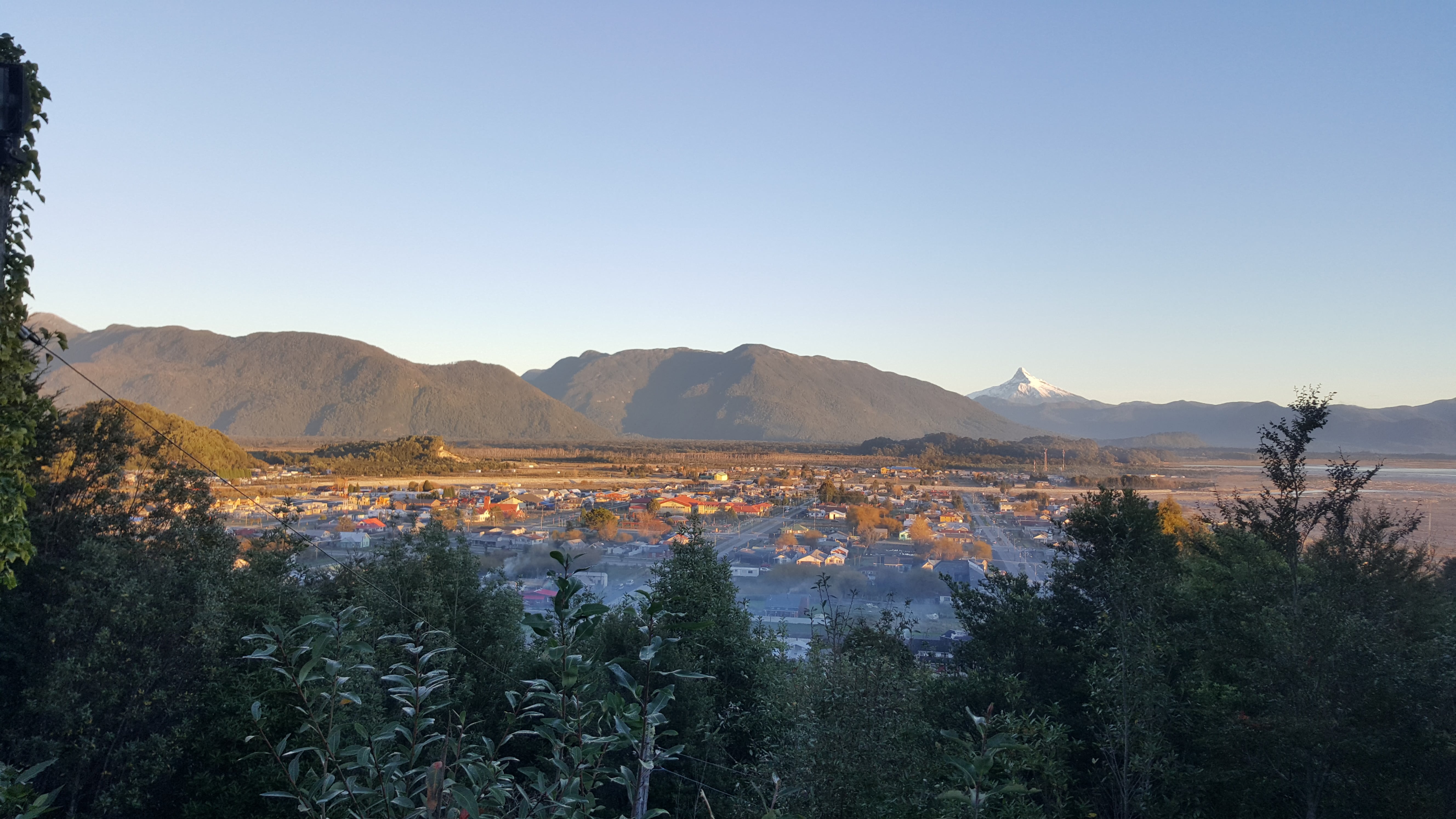 View of Chaitén from a wee hill. You can see a thin layer of smoke hovering above the houses.
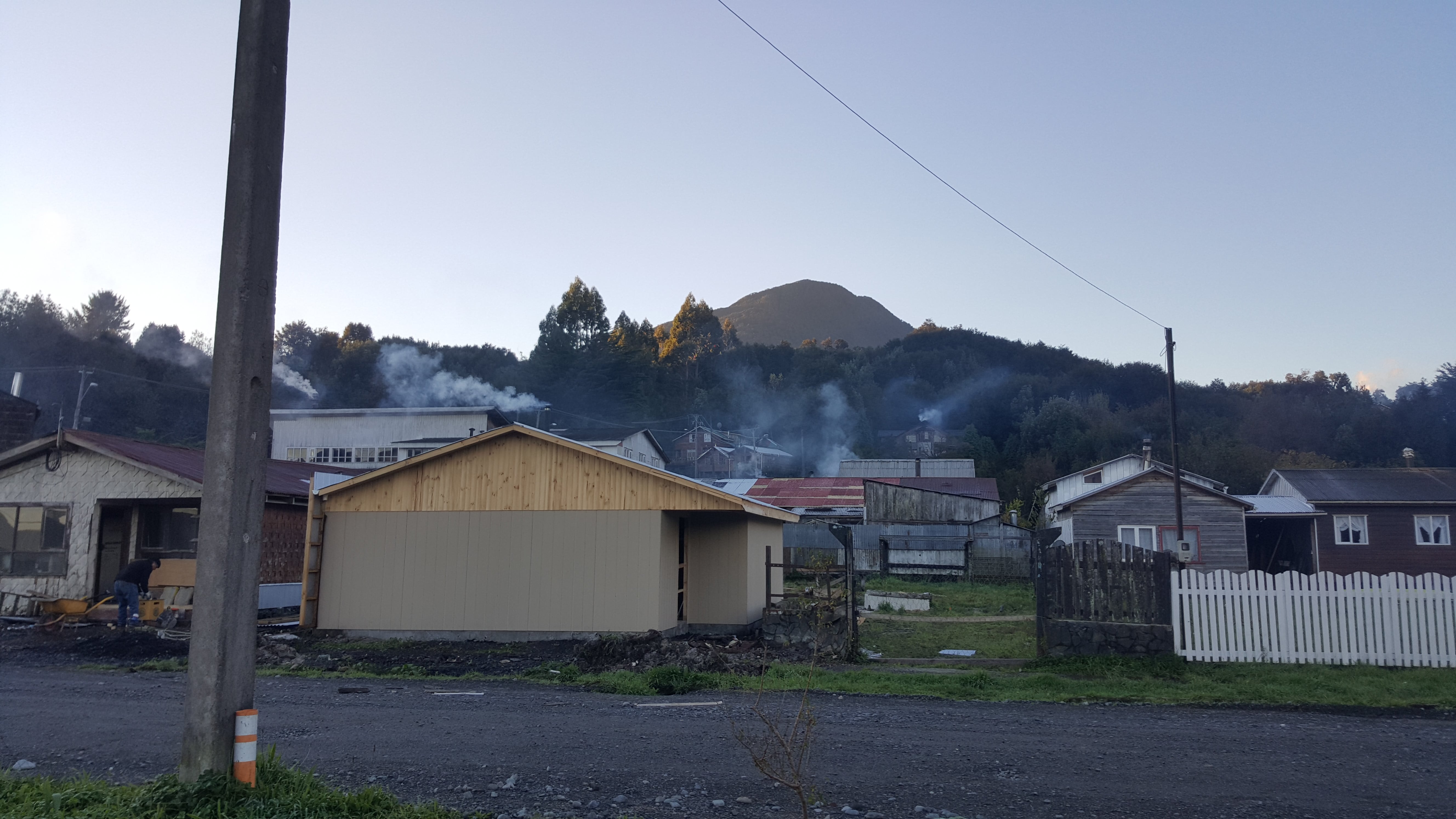 More smoky houses on a walk through town...
This only added to the fact that the town is very close to an active volcano. Well...multiple volcanoes actually but let's focus on one in particular. A volcano that once before had already destroyed Chaitén entirely. In 2008 Volcán Chaitén erupted. Luckily the town was evacuated before lahars caused the town to be flooded which destroyed major parts of it. Lahars are mudflows made of volcanic debris and water. The volcano continued to erupt and produce an ash cloud for several months after. The town now sits 10 km north of its original location. You can still visit the old location, Chaitén Viejo (= "Old Chaitén").
The bandwidths of eruptions like this one are significant. Besides the evacuation of an entire town, thousands of lives, and the surrounding area of the volcano, large parts of southern Argentina and Chile have been covered in ash, impacting agriculture and alike. A reminder that we all are living on a rock shooting across the universe. Very much alive with temperatures so high it's hard to imagine, just below the crust we are walking on. Containing forces that every now and then make their way to the surface of this Earth.
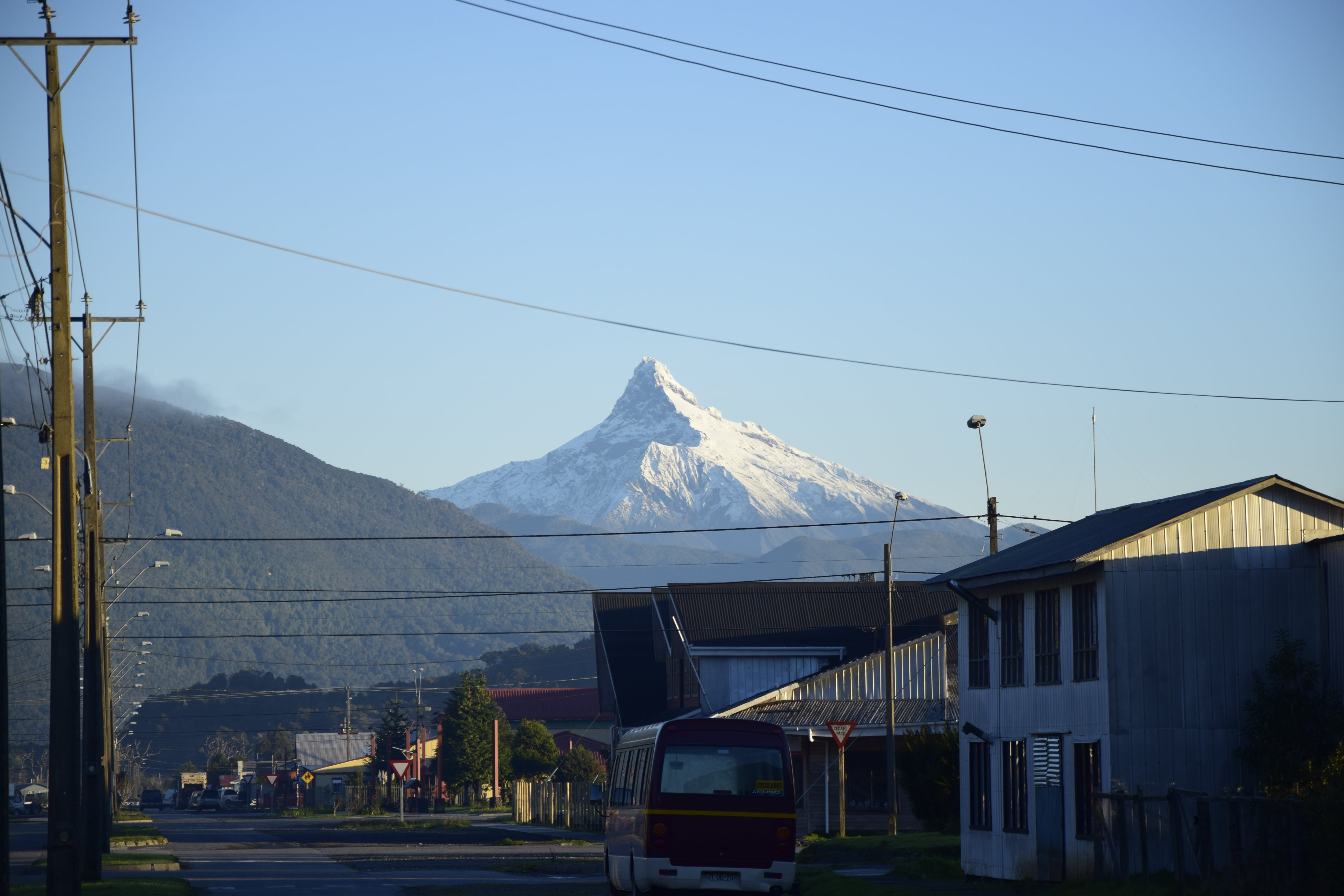 Another volcano, Corcovado, visible from the town centre. I love the significant shape of this one.
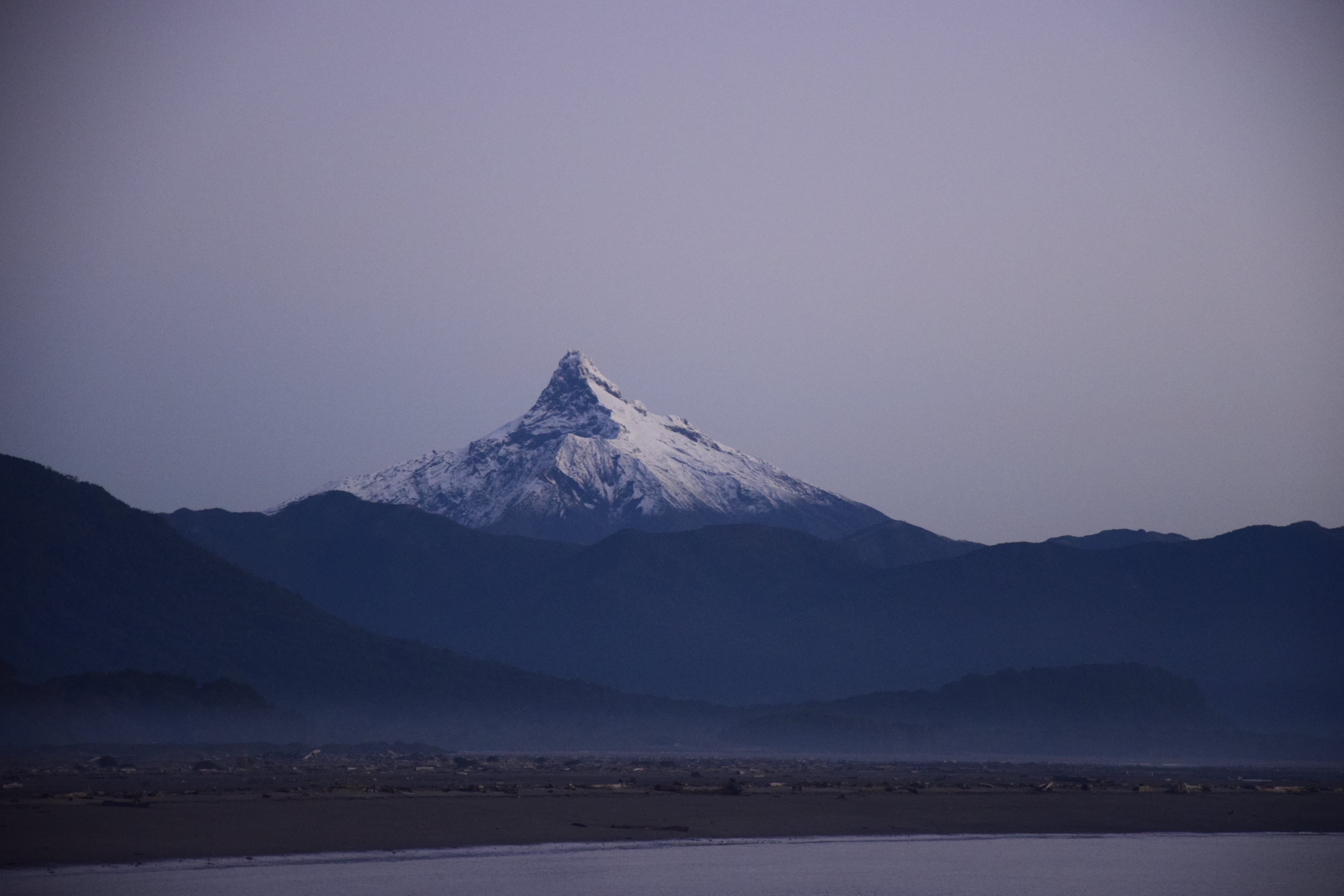 One more shot of Corcovado in evening light...
Stories like this one and my very own experiences in this town stick with me. There are beauty but also very overwhelming components in the awareness of such things. Being aware of the history of a place and its beings while at the same time spending my current moments in the same place. I think when we open ourselves up to places and its people, there's a small, maybe sometimes bigger, chance that we are able to actually feel whatever energy is present in said places. Maybe one of the reasons why we sometimes feel more, sometimes less connected to a place or a person.
As for the star of this story, Chaitén, I guess there was such a connection. Despite the short time we stayed there, just a bit more than a couple days, I remember the time there very vividly.
We stayed at a campground called Tierra Viva which I can recommend. It has the charm of backyard camping at a very good friend's house and is very laid back just like the rest of the town. It actually is the backyard of the super friendly owners with extra toilets and an extra room with seats, table and a wee cooking area. For some reason the owners' toddler was really into the idea of wanting to play with me when we first arrived, and from what seemed like only me. I did for wee bit until Darryn and I started putting up the tent. No valid reason to stop playing for the little one which made for scenes like the one on the image below. Darryn had a blast and I learned how to pitch a tent with a child around my neck ;)
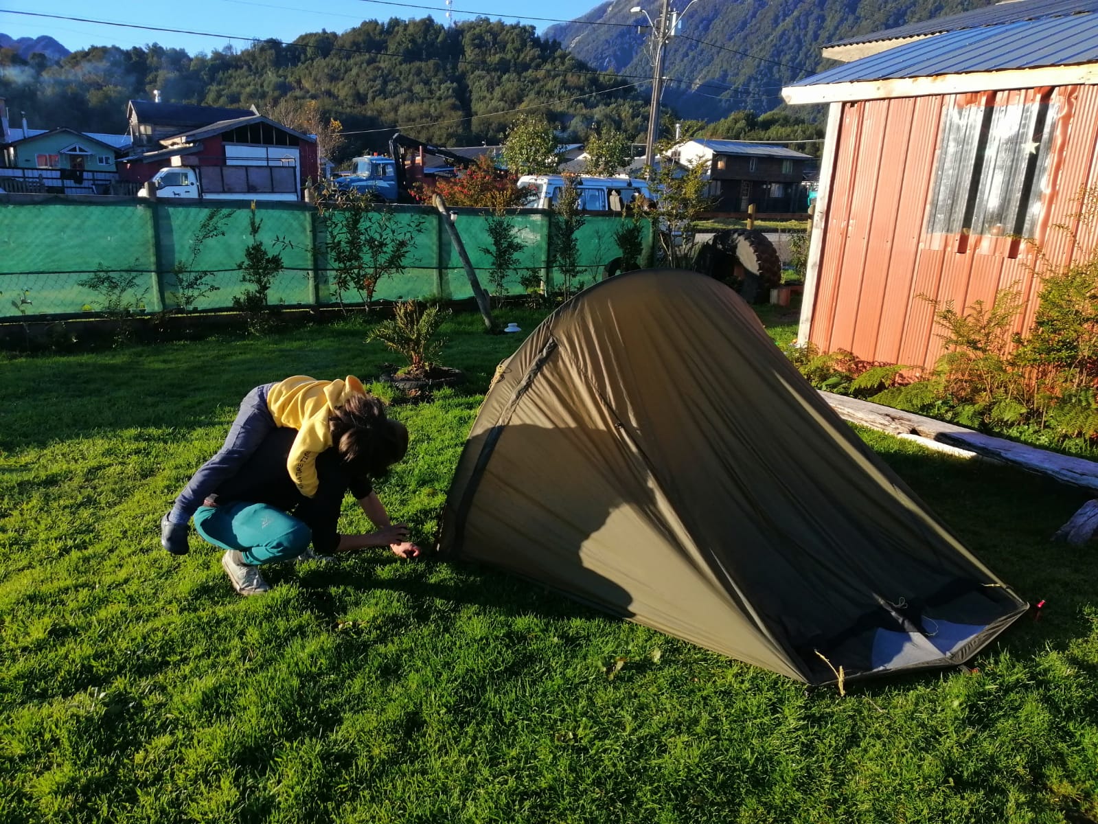 Learning to pitch a tent with a toddler around my neck :)
While we were there we overlapped the stay of a couple from Czech Republic, a cyclist from Japan and a guy from Argentina. We all became reasonably close for a couple days due to the small space.
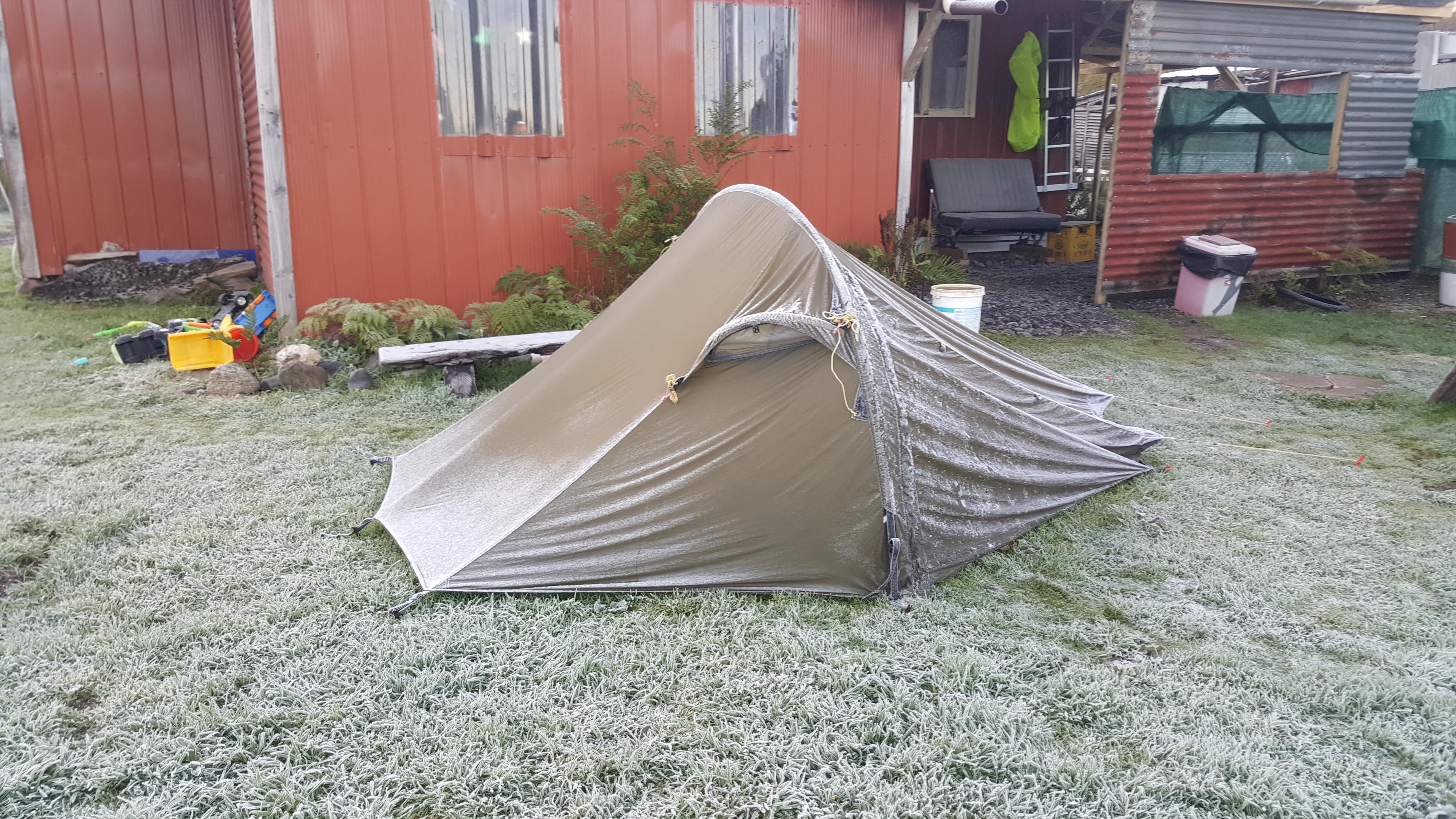 Cold nights, frost on the tent in the morning...
Darryn and I went to hike the volcano the day after our arrival. Together with José, who's from Argentina and has quite an interesting background story. One that's taught me another lesson in appreciation and served as a wee reminder that it is always up to us what we make of our individual situation. He spent years of his life working to save money because he wanted to do what he did when we met him: travel. But instead of doing just that, he worked for as long as he'd have enough money to buy his mother and his sister a house. His travel budget was a third of that of mine. Whenever he made himself food he'd offer and share with us.
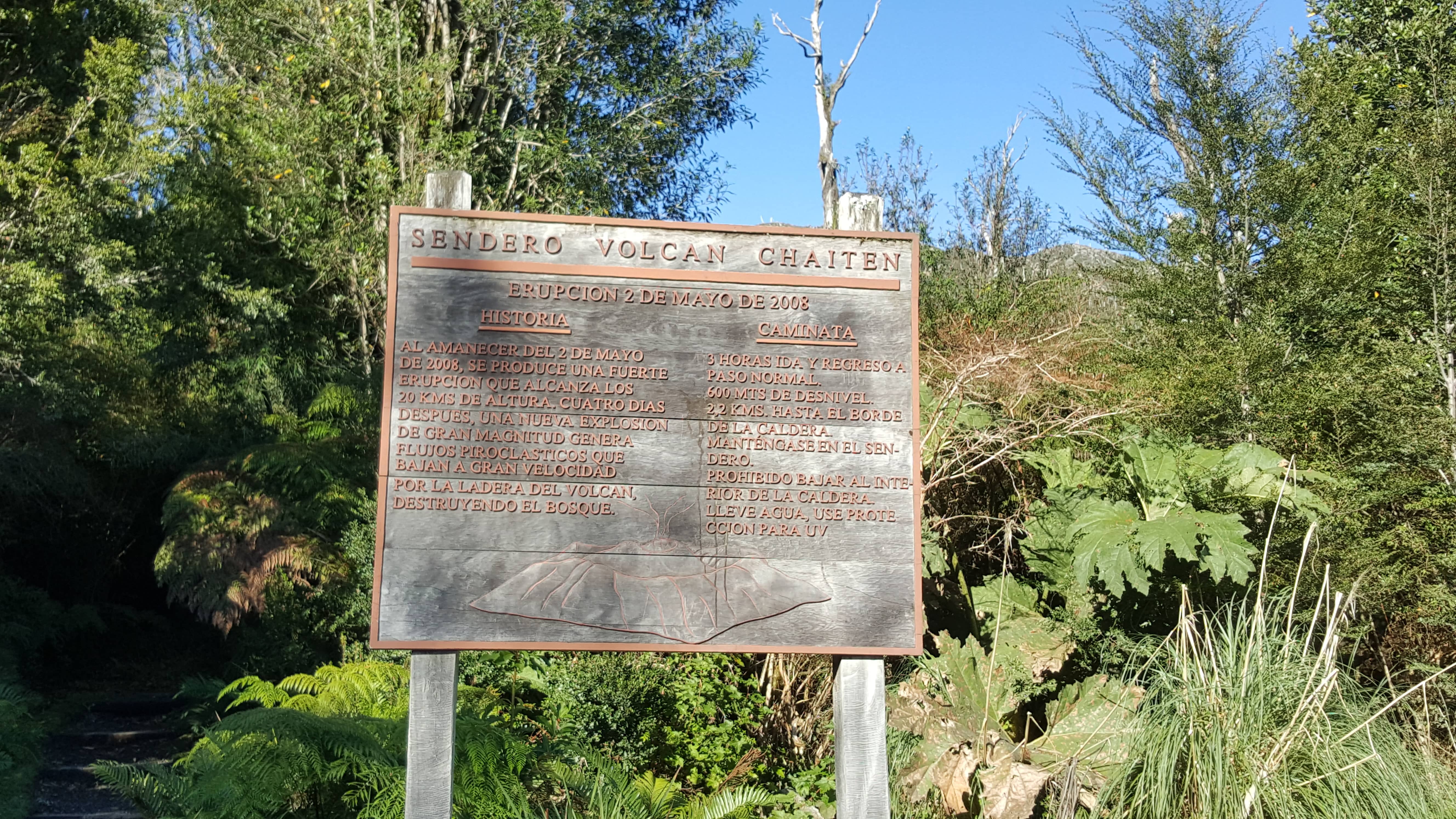 Sign at the start of the sendero with some notes about the 2008 eruption...
A car park is accessible directly from the road, so we left Murphy there and went our ways up to the caldera. A few months prior I'd seen a volcano, as far as I can remember for the first time in my life. But that one has long been claimed extinct. Volcán Chaitén was the first active volcano for me to visit. This made an otherwise relaxing walk quite exciting to me. Another thing that stuck out and fascinated me was the vegetation. Dead and alive. Fields of dead trees in the midst of flourishing green flora. Again, having in mind what had happened just a little over a decade before I came to cross this path was simply mesmerizing.
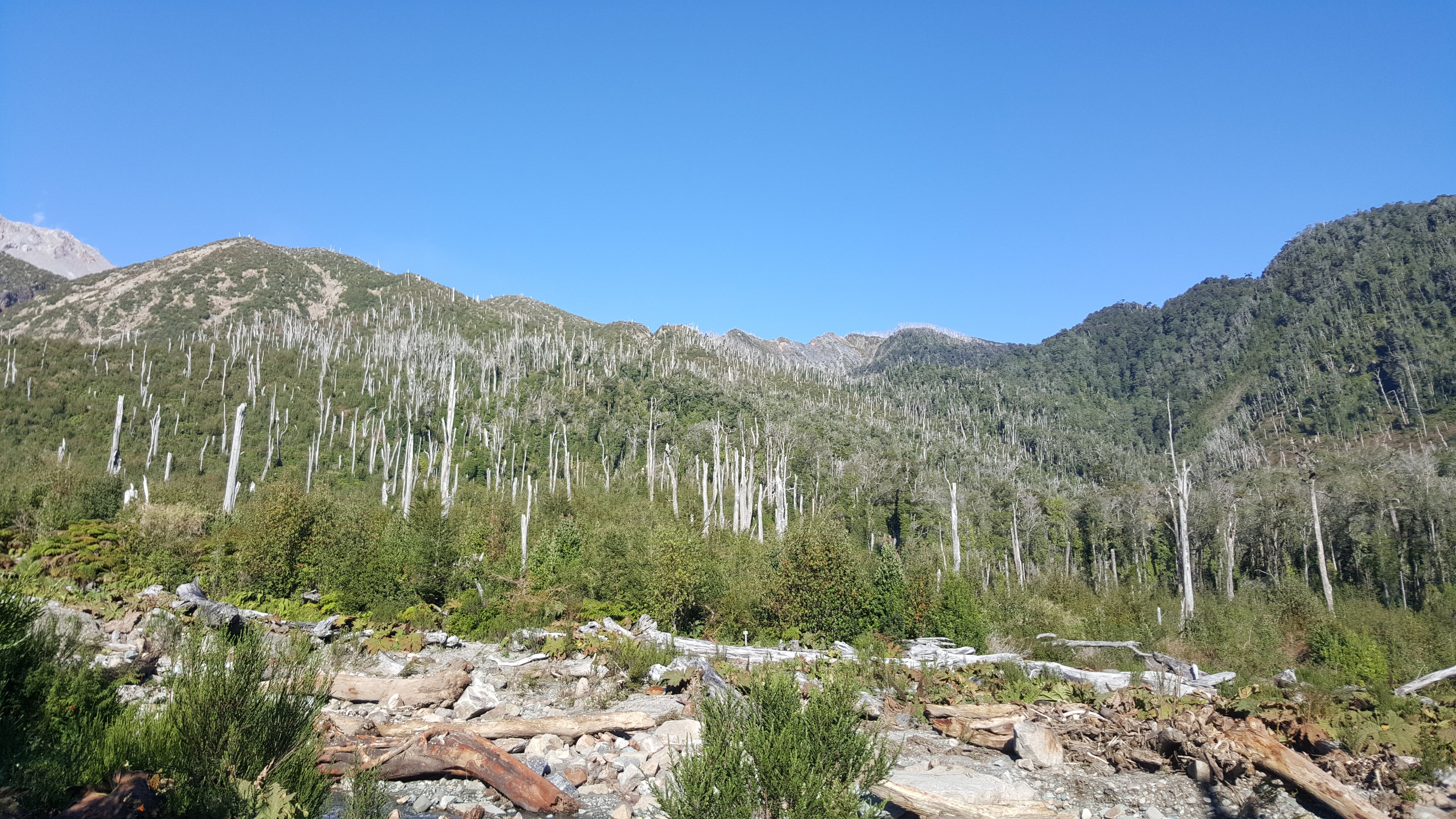 Fields of dead trees...
 ...becoming part of Life again
This walk is short but full of impressive views. Towards the top it gets a bit steeper but nothing too much. Stairs are installed. The three of us were by ourselves for the whole way up and down. I've read afterwards that this hike is a relatively popular destination with travel agencies offering guided tours with transport from and to Chaitén.
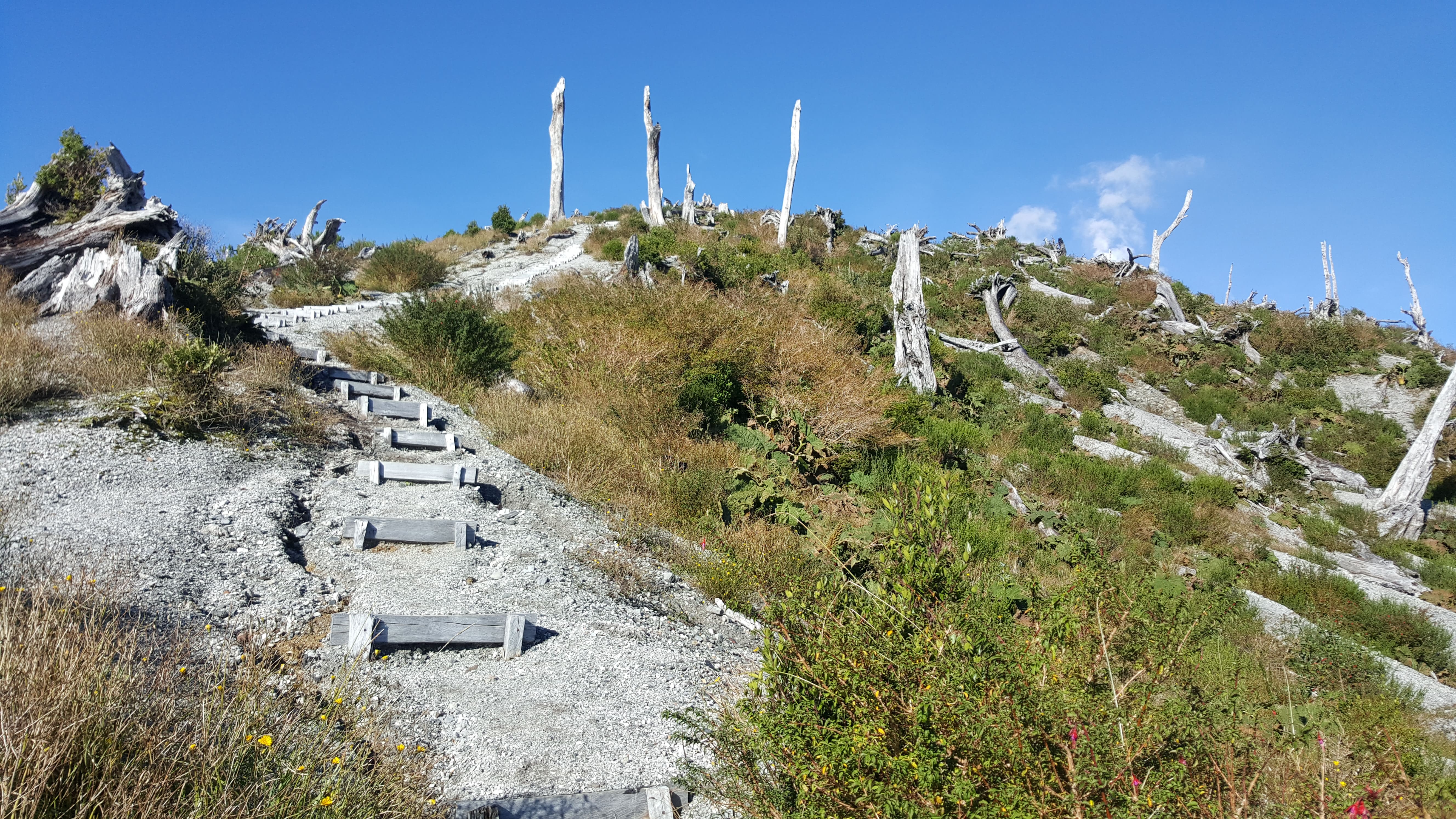 Stairs on the last bit to the edge of the caldera. Smoke coming from the volcano already visible at the top right of the image.
I assume a reason why we didn't meet anyone else is the time of year. Patagonia in late autumn and winter is not for the faint hearted :P It's very nice when you're warmed by sun meeting your skin. As soon as the sun is hidden behind clouds, maybe add a bit (or lots more) of rain, snow or other kinds of precipitation, and you get a kind of cold that creeps right into your bones. That being said, the sheer beauty of this region offers a fair bit of distraction from the temperatures and maybe the occasional uncomfortable weather conditions.
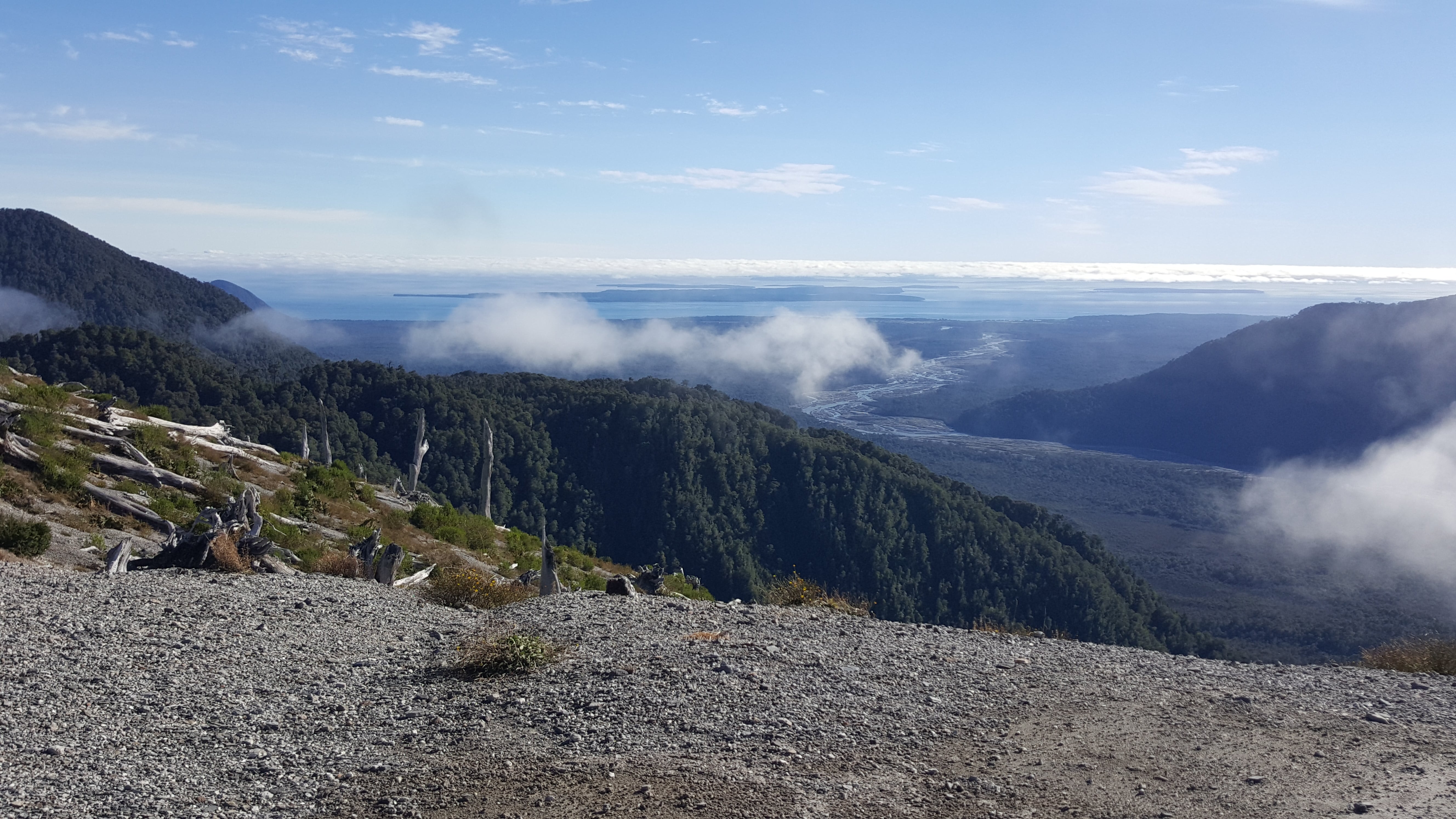 Views of the Gulf of Corcovado and the islands around Chiloé...
Once we've arrived at the edge of the caldera we found ourselves a spot for a maté break. This is always a good way to relax at whatever hiking destination and enjoy some views, no matter if the break is even needed or not. I've spent several hours on many tops sipping away with company or by myself, sometimes watching people come and go, observing weather changes. Taking in the beauty of Nature, the major reason that got me there to start with.
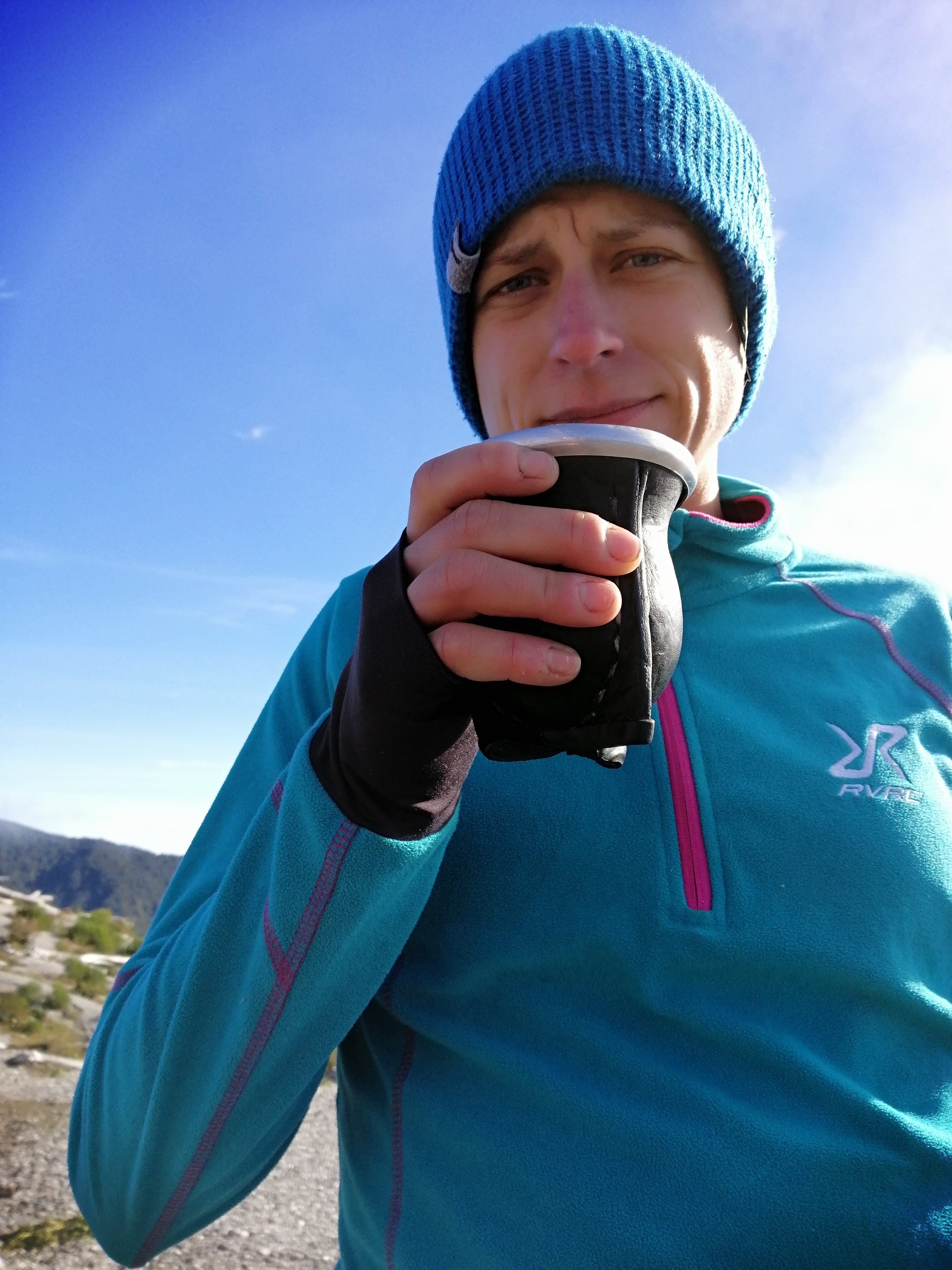 Matéééééé!!! :)
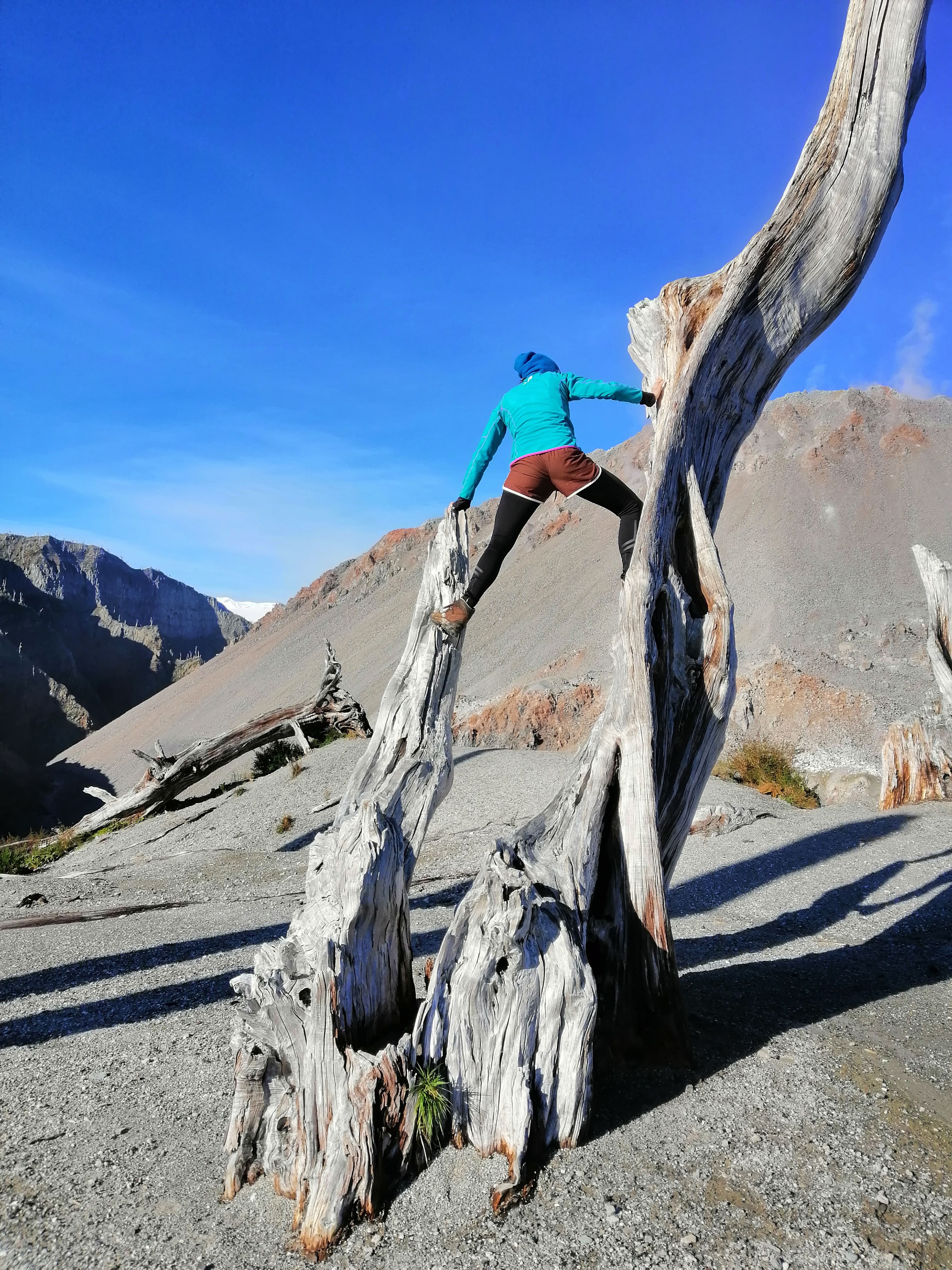 "Climbing session" with a volcano in the background...
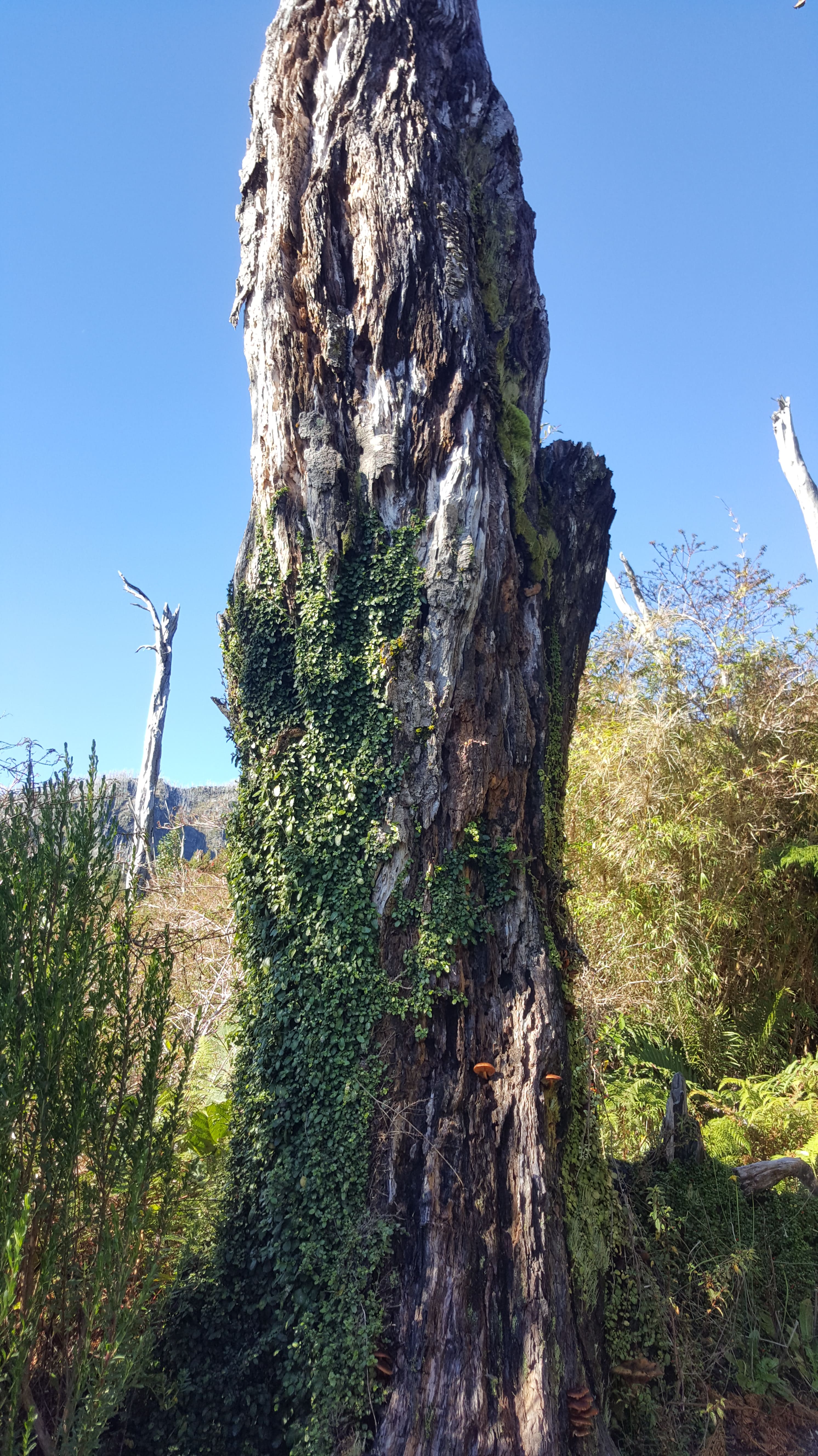
The weather was perfect for having a maté: endless blue sky with warming rays of sun on a Patagonian autumn day. A collection of trees, before the most recent eruption probably lush green and now a grey silhouette of what once was, served as a wee playground for some long overdue climbing. The grey trees at the top made the environment seem peculiar. Due to the lack of lively soil the location of the trees seemed random and really made me wonder what it must've looked like here over a decade ago.
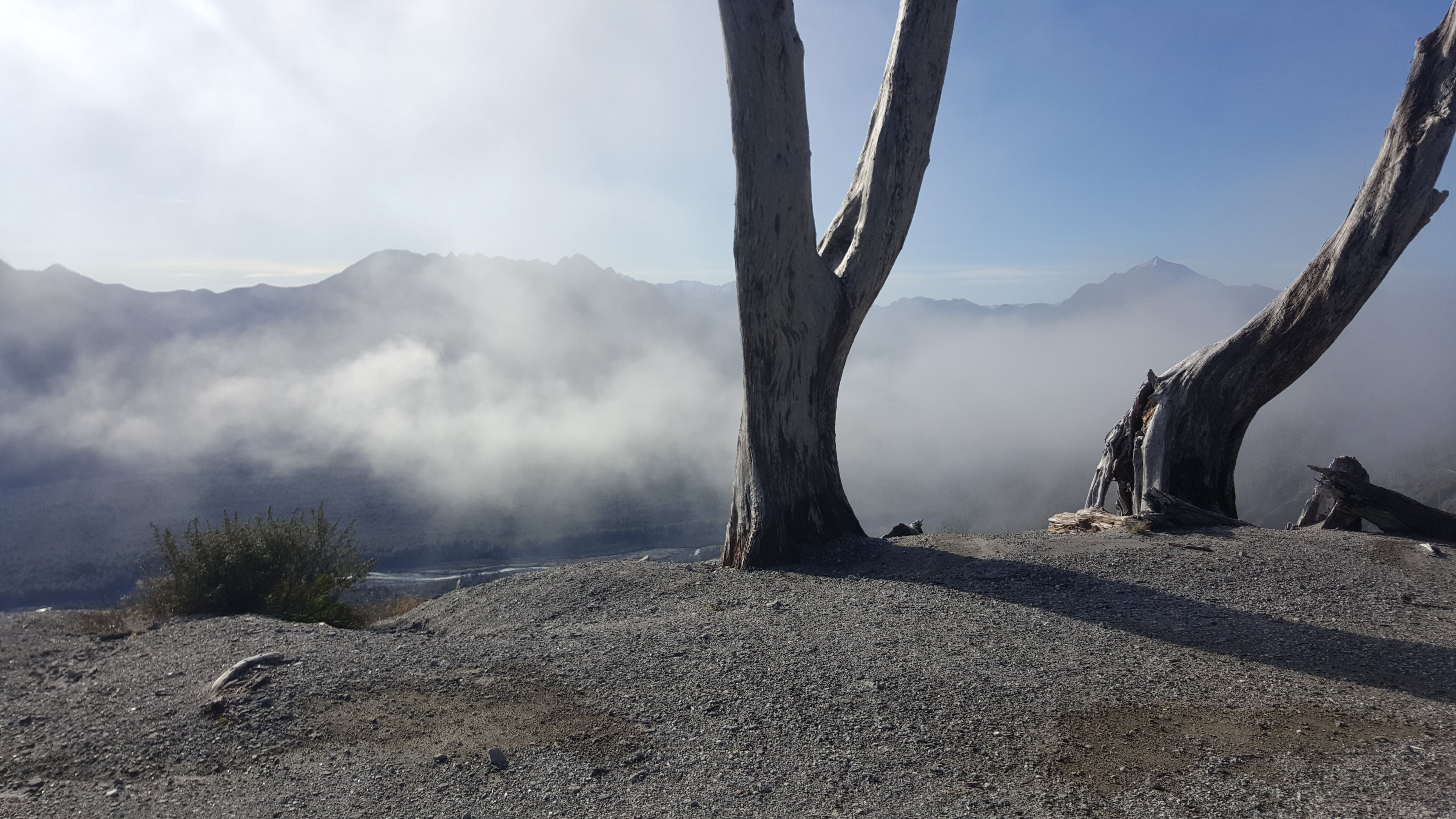 Peculiar trees around the caldera in the midst of the smoke coming from the volcano...
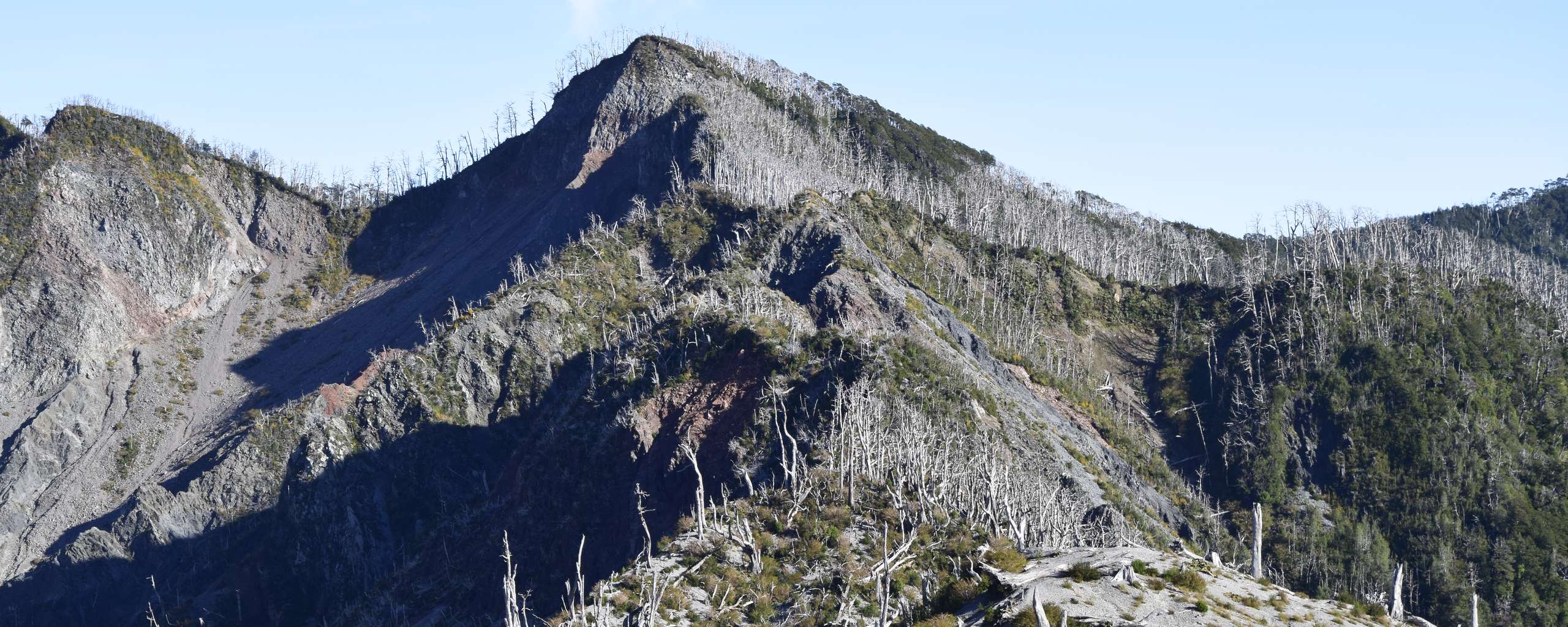
We explored the area around the caldera a little bit before making our way back to the car park. I probably took thousands of photos (as always, haha, hm...) to make sure to have enough images to be able to get back to this moment later in life. This time it definitely paid off. When writing this article I found myself comparing the images I took to images available online, before and during the eruption. Resulting in finally being able to make out the entire caldera which, frankly, I wasn't when visiting. If I understand correctly, what you see on the last image is the caldera with an estimated diameter of 3 kilometres and the peak in the middle is a lava dome.
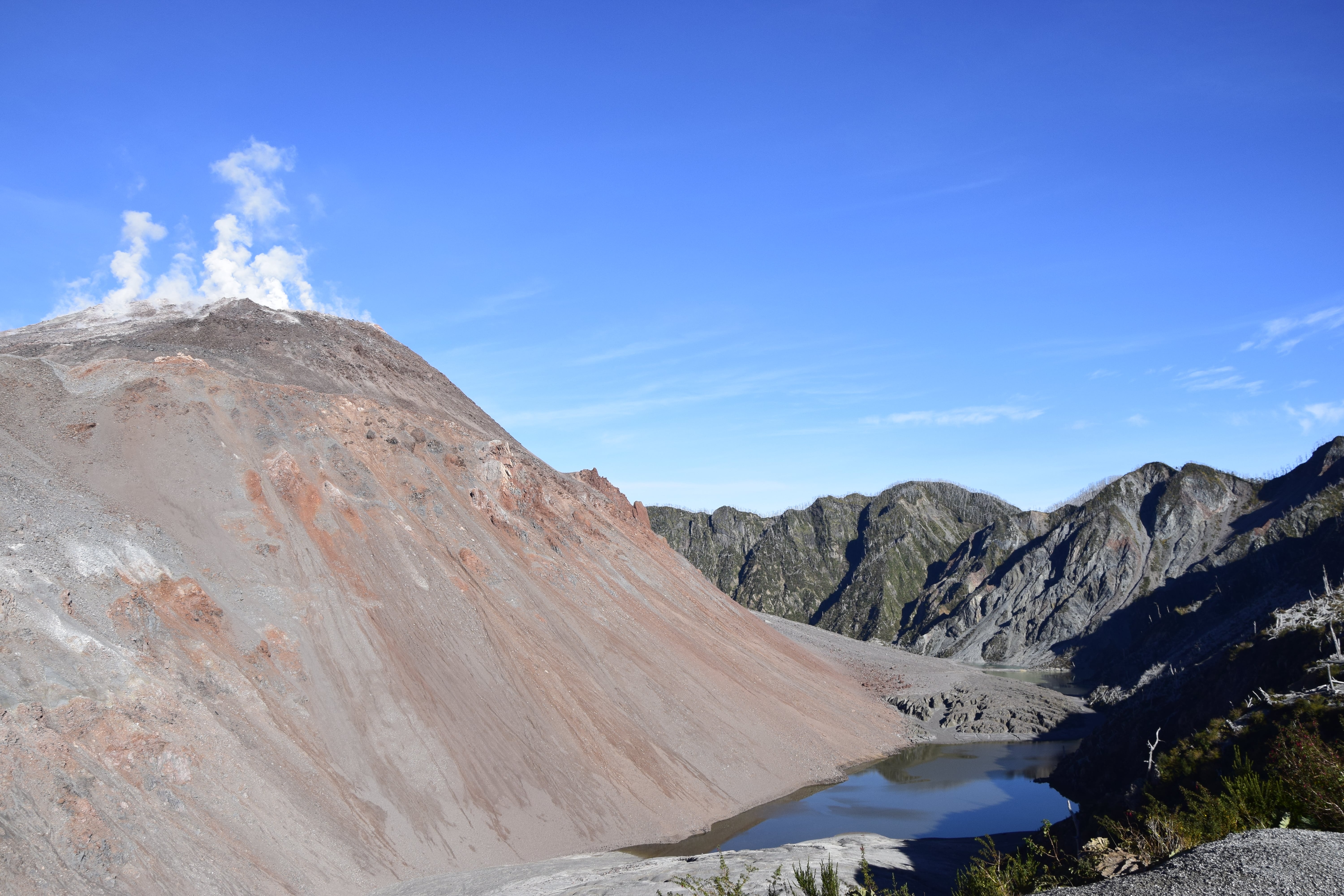 Volcán Chaitén...
Upon visiting this volcano I had no idea what a caldera is and was expecting a crater, looking like what I'd seen on images before or with the inactive volcano I visited a few months prior. So, arriving at the top and expecting to look into some sort of crater, I was a tiny bit confused about the steaming peak surrounded by this valley. From what I understand, a caldera is created by an inward collapse whereas a crater is formed by an outward explosion of a volcano. The most visible difference may be the size, calderas are usually much bigger than craters. If you want to read more about the difference including other examples, check out this short article.
Leave a comment*
(*Please see A word or two.)