My Experience
The first day of the hike starts out with heavy winds, some clouds and sunshine. It takes us a bit longer than usual to get started and fuel the bodies with some breakfast. We slept in a car that was shaken by wind all night. Sometimes it would feel like the car is going to take off from the ground. So not much sleep it was for us. I'm still psyched for the hike. Yet.
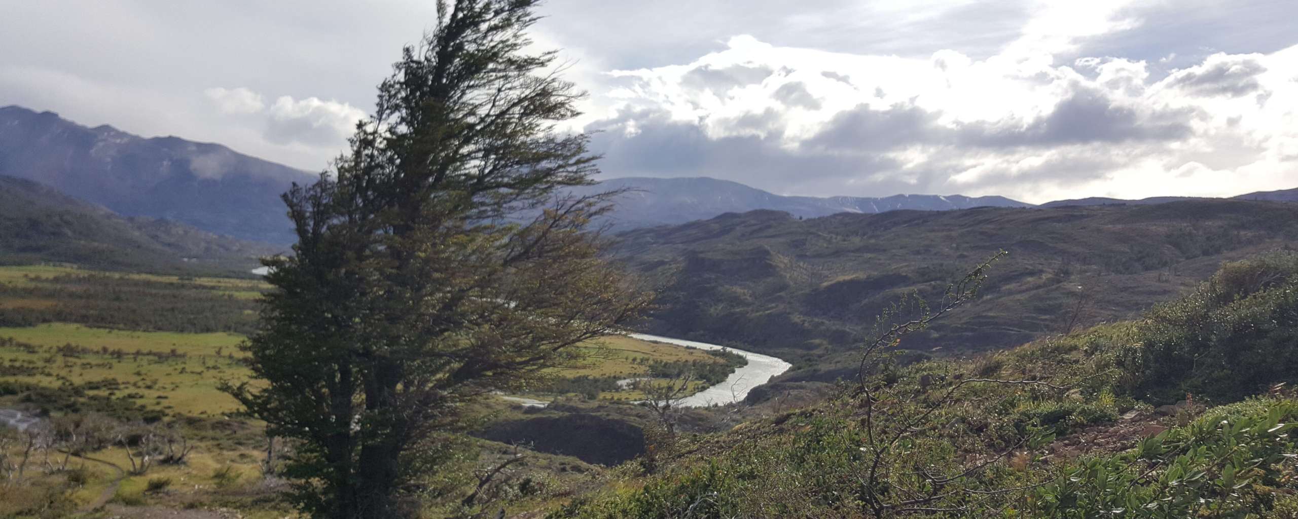
The first part of the track goes through farmland. It’s a pretty even up and down all the way with some steeper and some less steep sections. If it wasn’t for the long distance, weather and flooded sections due to weather, I’d say this is a nice way to start a multi day adventure with.
The views keep me distracted from the heavy load on my back. Just before we arrive at Camp Séron, it starts raining. According to the map, we’ve made the first 13km by then, a little more than one third of the day. Yay...
We use a coffee break to sit out the rain. At least that is the plan. Only Patagonia doesn't give a darn about any plans and spits some more water down at us. The camp is closed entirely, so the only shelter we find is not wind proof and provides only a bit of protection form the rain. As we get colder, we decide to keep going. Walking will keep us warm.
I walk and walk. My shoes are filled with water. I stopped feeling my toes a while ago. The gloves on my hands are dripping from water. I can’t feel my hands. I am completely soaked and freezing.
The path ahead is barely visible. All day I’ve been fighting the winds just to keep my feet on the ground. With that monster on my back. For the past few hours it’s been raining consistently. The masses of water are coming at me not only from the top but from all sides, smashing against my face. While my body has literally been screaming at me to get warm and rest for the past hours, my mind has kept on fighting. “We need to get to the camp. There’s no other choice.” I have no idea where we are and how long it is still to camp. It must be at least 10 km. I’m tired. I’m exhausted. I’m giving up.
I turn around and look at Christian. He’s as soaked and has been having cramps. We decide quickly to put up camp at the spot where we are, warm up and keep going once the weather calms down. Heads up: The weather won’t calm down all night. It will get worse.
I found out later that the spot we picked for our emergency camp is one of 5 spots that is marked with “heavy winds” on the paper map we carry with us. Average winds of about 130 km/h were measured that day. Aren't we lucky.
We start putting up the tent together but Christian takes over completely. Without any feeling at all in them my hands are useless. I keep dropping pegs and am too slow. The world is still pouring down on us. So, I start getting towels, sleeping bag, and some dry clothes trying to keep all of that dry. I need a while just to open and close the backpack, because I can barely move my fingers. Without communicating about it, Christian gets some food that will later give us some energy for the night. We leave our backpacks under the rain covers outside hanging from the fence. There’s not enough room for all of it inside the tent. With this decision made, I give up on my camera and anything else inside the backpack that is not water proof. No way, our backpacks are going to stay dry out here. It doesn’t matter. All that matters is getting warm and dry.
We were clearly not prepared for this.
As a reference, the spot for our emergency camp was a fence that divides the Séron sector from the Coirón sector. We didn’t know in that moment but the Coirón ranger station was “only” about 60 mins away from where we camped in our first night.
We got to this point because of a series of naive mistakes made due to inexperience and a fair share of ignorance. When we arrived at Camp Séron, which was closed, we decided to keep on going despite the horrible weather. We marched right into it. I left my shorts on when we left that camp. Rain water went into my shoes from the top and was collected inside, so I was walking with a pool inside my shoes the entire time. I also left my gloves on trying to keep my hands warm. But these were completely soaked resulting in the opposite effect. Always make sure to keep your extremities warm and dry. If they get cold, your whole body will cool down quickly.
Christian was wearing a jacket that wasn’t water proof. He planned on treating it before going on the hike but he didn’t. He was completely soaked and his body cooled down. Mixed with the heavy backpacks and winds all day, the 20km that we’ve already walked, our bodies were simply exhausted by the time we decided to camp.
And remember how I knowingly ignored the weather forecast at the ticket center the day before? Let’s face it, that was arrogance at its best. That forecast was literally screaming at us “Get prepared, newbs. Patagonian weather is coming for ya!” When I did the O-Circuit I wasn’t new to hiking. Even though I’ve never done a multi day hike before, I’ve done a few supposedly challenging day hikes prior to this hike, including, at times very, uncomfortable weather.
But…up until then, I’ve never seriously experienced my limits. I was really fit.
So, there I was, about to do a multi day hike in a region that is known all over the world for its challenging weather and tracks, thinking to myself “Even if it gets that bad, we’ll make it. Why wouldn’t we.”
One really important life lesson: The moment you think you know everything, you probably haven't got the slightest clue. The more experiences you make in any area of life, the more you’ll find out that there will never be a point when you know better or everything or are done learning. Never.
Needless to say, the O-Circuit was the last hike I did without being informed of what’s ahead of me. Even though, we were aware that we had a very long hike ahead of us the first day, we only had a rough idea about the other days. We just took it day by day.
That’s how I used to do hikes before this, including the O-Circuit itself: Pack food and get going. The rest will come later. No weather check, no elevation check. Just roughly looking at distances and whatever are general estimations for trekking duration. Well, I learned my lesson(s)...
Leave a comment*
(*Please see A word or two.)